Pages

Friday, October 26, 2012

Elcho Island to South Goulburn Island


Thursday - 25/10/2012 and Friday - 26/10/2012

(This chart shows our track from Gove to Goulburn Islands in red, the purple line identifies the Telstra Wi-Fi Internet service in these parts)
 

As I have said before we have Plan 'A', Plan 'B' and whatever, this is why people in this type of cruising life need to be able to sail at night.

We left Elcho Island before light this morning running the engines for a while to charge the batteries and getting clear of the headland, as the sun came up the wind came, not great wind but enough to sail. The engines shut down and we are under sail but only sailing at 4 to 5 knots but sailing which is good. Our plan is to sail the short cut through Milingimbi Inlet this area is listed as not surveyed or unsatisfactorily surveyed so we have to keep a very close watch, as I mentioned before where this area has been surveyed it was a very long time ago the chart has identified areas that have been reported that go back as far as 1937.

As we approached Milingimbi Passage the wind became sheltered by Crocodile Island on our starboard side, the waters were a beautiful blue colour and you could see some of the shallows. The other problem we have is that our paper charts that we purchased which is the full portfolio of charts between Cape York  to Port Headland do not have the close in scale from the bottom of Elcho Island to Cape Stewart it only has the broad area chart which does not show the greater detail of this area probably because the information is not reliable.

I have two chart plotters a Raymarine and a Garmin and it is surprising at times the difference of items and depths that are shown to be different with each other although the charts in each were purchased in the same year.
(This was our original planned route on C Map charts)
(This is the route I took, it probably would not have mattered if we had the tides right given that the tide difference is 3 metres and we were near low tide)
 

The electronic charts like the paper charts show a dotted line passage through Milingimbi Inlet and has written along it UNSURVEYED but it is unclear which side the line they are talking about because they have depths charted on both sides. I also have charts on my computer which indicate the passage to be down the centre and that is what I decided to do was follow that. About half way through I start to run out of water in the end I followed the starboard dotted line and found plenty of depth along this line  and continued to follow it right the way through and all was well, I must say though we had checked the tides at Crocodile Islands but found on the electronic charts there was another tide chart near Milingimbi that was totally opposite we were at low tide not high tide.
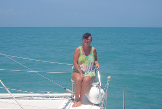
(Nancy on the bow as we pass through Milingimbi Inlet)
 
Milingimbi brings me back to the days I was on HMAS Attack in 1968 we patrolled the north coast and would come to these missions, I was fascinated with Milingimbi Aboriginal people lived in this mission under Methodist overseas mission information can be obtained on website, http://en.wikipedia.org/wiki/Milingimbi_Island

What seemed so special in those times to me was that the area was well run and the Aborigines appeared to be very happy, they had split the mission into two different areas one the new time and one the old time and the Aborigines could choose which they wished to live. They had built cold rooms and had purchased a trawler and they would fish and send their catches to Darwin for sale along with their art works. The mission all ended in 1974 when the Aboriginal people got their independence, I believe that they are doing very well although I cannot help but think that in some cases the Aboriginal people have had the mission people replaced with some bureaucratic systems such as some land councils that are staffed by white people but I can't say for sure. It was fond times meeting these people and sailing these waters with a great crew that we had.

Our plan 'A' was to anchor at Cape Stewart which we found to be unsuitable due to the wind and sea direction, Plan 'B' was for the bay just beyond that Boucaut Bay, we reckoned that we could sneak in behind the point of the bay and get some protection, this failed because when we looked at the electronic charts it showed up as Aboriginal waters with a boundary that went down the bay and we are not allowed to anchor there. The next choice was our planned next anchorage being the Liverpool River but we would not make it before dark and I am not fond of entering rivers I do not know in the dark and infested with crocodiles. The decision was made that we head to the Goulburn Islands and that would mean we sail all night. As we were leaving Milingimbi Inlet a Perkins Barge was entering the passage into Milingimbi and a little while later an Army Barge passed us the only other vessel we have seen for a couple of days.
(Our visitor, a young Brown Boobie Bird, it did not appear to be frightened by us as you can see))
(Sun sets into a night sail we go)


The winds were with us and we were doing some great sailing although a little uncomfortable and this was going to make it hard to sleep when not on watch. We sailed along at around 8 knots. I stayed on watch until sunset as I knew I would not sleep and Nancy made dinner after putting that fish we caught back in the fridge because we would not be able to use the BBQ in this wind, she cooked some great curried sausages and rice. Just before sunset we had a visitor a young Brown Boobie bird landed on the forward deck and looked quite comfortable when I found it, we did not see it land. It sat there cleaning itself and as the sun set it tucked his beak into its back and fell asleep and stayed for the duration, in fact I think it was the only one that slept on board properly. We had a great sail right through the night, not any real sleep but a good sail. Nancy had a nap when I took the shift at 2000 hours and I tried to sleep when she took over at midnight, in the end I went on the cockpit cushions and just fell asleep when Nancy woke me as we neared Goulburn Islands. We arrived at the Goulburn Islands and it was still dark we decided with wind and sea the best place to anchor was South West Bay on South Goulburn Island and as a bonus I had Craig's or 'Scarlett's' waypoint for the anchorage from their around Oz trip last year. We rounded the point and noticed two other boats anchored but not where we wanted to go, one boat was well lit and looked like a patrol boat which ended up being a Customs patrol boat.
 (Chart showing Goulburn Islands)
(The anchorage at South West Goulburn Island Lat/Long shown)
 

We dropped the anchor just as first light was about to appear, our feathered friend was still with us and only moved away whilst Nancy got close to drop the anchor. After anchoring and tidying up we sat on the forward deck with our feathered friend and watched the sunrise, our friend was looking all around trying to find out where he or she was it was doing this continually for a long while, we could get very close to him or her and it did not appear to be scared. Our feathered friend had left several calling cards on the deck for me to clean up. The truth was that all the decks needed cleaning from anchoring at the islands with the fires and dust coming from them the boat was dirty, so I set to washing the decks with salt water after the sun was up our friend waddled to the front of the boat and finally went down to the water for a drink before flying off.
(Nancy with the feathered friend)
(The sun was up the bird waddled, boobies waddle with their web feet, went to the water dunked the head and had a drink then off it went)
(Early morning light)

When I had finished cleaning the Customs vessel called on the radio to take our particulars part of the coastal watch process they were very polite, I gave them our details and wished them a  good day as they did us.

(Customs patrol craft)
After the bird had gone we had breakfast and then I went had a wash and had a sleep today is a rest day we sail again tomorrow.

The following is an extract from the internet, it is unfortunate that we have not received any permits from the Northern Land Council, we emailed the Darwin office in July/August and did not receive an answer, the young lady in Gove said she would email the permits through it may be that it takes time to get them but we have not received anything to date so we have to respect the land owners and not go ashore.

The North and South Goulburn Islands are located in Auray Bay off the northern Arnhem Land coast. The islands are Aboriginal-owned and permits from the Northern Land Council are essential for all visitors. The Goulburn Islands are not set up for tourism, but intrepid sailors and fishermen may occasionally find themselves on their shores.

The Warruwi people are the traditional owners of the Goulburn Islands and the main language, Mawng, is spoken by about 750 people. Warruwi community is located on the southern tip of the south island and is a dry community (no alcohol). Fishing is the main pastime of local people, who are allowed to hunt the turtles and dugong prevalent in the area. The lifestyle is slow and relaxing and the climate is slightly cooler than Darwin.

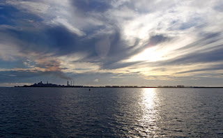
(Sunset from the Goulburn Islands)
 
Cheers


Gove to Wessel Islands - Through The Hole In The Wall


Up early again this morning and did some scribbles for the blog but unfortunately could not upload it because we are on slow time as we have used our monthly amount so have to wait a couple of days. As soon as it became light we started to get going putting the covers away warming the engines, closing hatches  etc. A large yacht 'Ocean Pearl' left just ahead of us they are also heading to Darwin but they are motoring at 8 knots so they will leave us behind. There are three blokes aboard we met a few times ashore we informed them about the tides at the 'Hole in the Wall', they were going to go through it at the wrong time. 'The Hole in the Wall' is a narrow waterway between Guluwuru Island and Raragala Island named Gugari Rip, but is known as the hole in the wall.

Gugari  Rip tide flow can reach speeds of 8 knots plus and the direction of flow is it floods to the east and ebbs to the west and the best times to go through heading west is the first or last hour after high tide, the first hour being the better. The confusing part is when approaching Gugari Rip from the east the tide up to the rip floods to the west. This is good in the sense that you time your arrival for high tide and you have the tide with you all the way.

Before we left this morning we had to wash the decks with sea water as the decks were covered in red dirt and with the morning dew it made quite a mess after cleaning up we weighed anchor and motored out of Gove Harbour, a ship was loading at the jetty and we had to go through a heavy dust haze that was coming from the conveyor belt. No wind to sail by and we had to motor so when we were clear of the harbour I shut one engine down. After a couple of miles a little wind kicked in but not enough to sail alone but enough to motor sail. Having the last ebb of tide coming out of the harbour gave us some extra speed and by the time we cleared the harbour and the tide change we had the flood tide with us all the way to the hole in the wall.
(A ship loading as we leave the harbour. You can see the cloud of dust at the front of the ship coming from the conveyor)
(Gove behind us with an interesting sky)
 

Our original plan was to go to Margaret Bay the other side of Cape Wilberforce but we left a little earlier than planned and we were doing a good speed we realised we could get to the hole in the wall by the change of tide.

After we left the harbour I put the trolling fishing line out and I noticed on the chart that there was a small area ahead that showed a contour line where the depths went from 28 metres to 17 metres so I headed straight through the centre of that patch and sure enough we caught a good size Spanish Mackerel enough for four meals for the two of us.
(One Spanish Mackerel and a good size)

The other yacht 'Ocean Pearl' disappeared over the horizon and as we started to calculate the time for our arrival at the hole in the wall I said to Nancy they are going to get there too early if they are going to the same place. It is a little dangerous to try going through the hole in full flow unless you have a very powerful motor boat, the information given on the Gove Boat Club website states that The Hole in the Wall is a major topic in the bar of experiences had from people who did not get the time quite right. On the way to 'The Hole in the Wall' takes you through two other passages, one just after Cape Wilberforce between Point William and Bromby Island and the other between Cotton and Wigram Island 6NMS further on both of these flood to the west so we had the tide with us.  Both of these passages are quite beautiful with the islands and rock formations.
(Cape Wilberforce)
 
 
(Chart showing the passages and 'Alana Rose' postion at Cape Wilberforce)

An interesting point is that we had internet coverage all the way to Cotton and Wigram Islands, this is Telstra coverage like or hate them they give the better coverage around the coast and off the coast, as I mentioned before most Aboriginal settlements have Wi-Fi  towers, we do have an external  short black antenna on the stern of the boat mounted on the dinghy davits which helps get a better signal.
 
When we passed through the second passage we got NE winds which was not predicted and we had a beam on swell which made things a little uncomfortable, it is just over 15NMS to the hole in the wall from the second passage and it was a rollie ride all the way.

As we neared the hole in the wall we were a little early so I slowed the boat to get there around the right time, ahead we could see 'Ocean Pearl'  then as we got closer I called them on the radio, the skipper said they got there 2 hours too early so they were trying a bit of fishing without any luck. I said to him that he can go through the passage first as he is faster than us.

They headed off to go through a few minutes early and I followed at a great distance and watched as they entered, I could see that as they entered the tide was flowing against them so I backed off a little, they called us on the radio and told us that it was still flowing strong and to wait a while which we did. 1400 hours was the tide change time and we started to enter then. I think we caught it at near still tide as I was able to go through at what speed I wanted to the tide was not pushing us one way or the other, there were a few rips that moved us side to side but that was all. Again it is something to see the landscape and the different rock formations. The land is Aboriginal Land and we are not allowed to step on the land other than in case of emergency. However, it looks like in earlier times some people have painted their names on some of the rocks in the passage including two naval ships HMAS Ardent 1978 and HMAS Wollongong in 1988 not a good example boys and girls.
(Entering the hole in the wall)
(The passge through the hole in the wall begins)
(Looking back)
(Chart of Gugari Rip or 'The Hole In The Wall with AR's position)
(One of the stated anchorages for those that get the timing wrong the can if possible sneak in here and anchor and wait for the tidal flow to settle)
(The passage is now behind us)
(Sorry the video is a little unsteady at palces as Nancy tried to walk around the decks taking the film clip)
 

 After going through the passage we had a slow sail down to the Gurulilya Bay, it is the third bay south on the island. It is a good anchorage we did get as close as possible to the northern side as there was a little swell coming in with the NE winds but other than a little rocking with the tide change which was mild it was very comfortable night. It is a shame we cannot go ashore on these islands, well in truth we are allowed to go ashore up to the high tide mark but no further. These islands have caves and Aboriginal paintings in the caves that were painted way before white man inhabited this country.
(Guruliya Bay anchorage, very good holding, with NE winds small swell that is why we kept close to northern end there are rocks closer to shore)

It had been a big day and getting up early and staying at the helm all day I was very tired so after a good feed of that Spanish Mackerel and a couple of drinks I was in bed by 2030 hours.

Wednesday - 24/10/2012


Got up around 0445 hours and put the kettle on, need that cup of tea to start the day, had breakfast whilst I knocked out a few scribbles before getting ready to sail. The air was still and seas very calm looks like iron sails today. As we left the anchorage we got a little wind just enough to put a sail up and motor sail which added an extra three quarters of a knot to our speed. It sounds very little until you multiply it by 10 hours and you have covered a lot more distance. Our plan today is to get to an Unnamed bay south end of Elcho Island near Ganawa  Point which is about 52NMS. We motor sailed around to the top of Stevens Island and down to Drysdale Island before the wind kicked in we then hoisted the mainsail and reset the headsail and we were off under sail alone. It is nice to cut the engine and just hear the boat cutting through the water. Since heading to Cape York and on to where we are now the country is on fire in different places the burn offs are continuous.
(Sails up with the headsail reefed as to stop the mainsail shadowing the wind that was near behind us)
 

I found the seas around this island group to be a little different to the charts in regards to depths and one should be aware of this for example before reaching Stevens Island there are a few contours on the charts showing the different depths, as we went through a patch that indicated 16 metres on the chart the depth sounder showed 30 metres, the 30 metre patch on the chart was actually nearly one mile to the south. At the top of Stevens Island it had a 50 metre hole not marked on the chart. This areas paper charts have a note that the sources of information were from the RAN Hydro geographical Office in 1993 and the upright figures on the chart are from previous unsuitable survey. There are many reporting's of information relating to depths written on the chart that date back many years so one must be very aware. Electronic charts do not provide that information. These areas are not used by regular shipping other than the barges that deliver good to the different communities and yachties and boat owners doing to Darwin run. The track I took I had no problems as far as going or finding any shallows the waters were all deeper than what was on the charts.

The islands we pass appear to be so different from each other with different rock formations and different vegetation. Drysdale Island has a pearl farm located there and apparently many of the islands up here have pearl farm leases.

The days sail was good and we covered the miles and anchored by 1540 hours, the day was very sunny and around 35C so the wind was nice to have to keep us cool as well as sail.

The anchorage here is good a little swell creeping in from a NE wind but not uncomfortable, Refuge Bay to the north would be a better anchorage however, we wanted to get the extra miles so we have less tomorrow, we have a 60NM sail tomorrow we hope we have some wind because the rest of the week looks hopeless and we have to use the iron sails (engines). Normally we would wait for wind but time is getting on and the cyclone season is coming upon us and I would prefer to be behind the locks of the marina than out here if an early one comes to play.
(Southern bay anchorage at Elcho Island, there are some rocky areas closer in, we found that this position was good for the NE winds)
(Yes another sunset)
 

Just for information again there is internet service here and was available for the 10NMS before we anchored which is great to get weather information. I do get the weather through the HF radio but the internet provides the seven day forecast and all the charts and radar.

Below is information from the internet on Elcho Island:

The island is home to the largest Aboriginal community in northeast Arnhem Land, with approximately 2,000 residents living in the main settlement of Galiwin'ku and across many outstations including Inglis Island on the namesake island and Matamata, Maparru, and Gariyak on the mainland. The island has a base population of 2,200 people, including 70 non-Aboriginal people. It is the home of the Aboriginal folk musician Geoffrey Gurrumul Yunupingu. The population of Galiwin'ku varies during the seasons, with many outstation residents migrating to the community during the wet season due to inaccessibility. The community also serves approximately 25 outstations with a total population of approx. 450 people, with 12 of the outstations on Elcho Island, which are listed from north to south:

  1. Nanyingburra
  2. Gawa (Gäwa)
  3. Banthula (Gampura)
  4. Djurranalpi (Djanalpi)
  5. Dharawa
  6. Gitan
  7. Gulmarri
  8. Watdagawuy
  9. Dhayirri
  10. Ngayawilli (First Creek)
  11. Dhudupu
  12. Galawarra

Forty-eight per cent of the population is under 20 years of age, with 7% over 50.

Galiwin'ku is a traditional Aboriginal community with restricted access; permission to visit is required by law and can be made through the Northern Land Council directly or via the Galiwin'ku Council. Total alcohol restrictions apply and there is no gasoline available on the island; all gasoline-powered vehicles use the low-aromatic petrol 'Opal' as a fuel substitute.

The settlement was originally established as a Methodist mission in 1942, with the arrival of Harold Shepherdson, a lay associate of the Methodist Overseas Mission from Milingimbi It remained under Church direction until 1974 when it became self-managed. Eighteen connected clan groups within the Elcho Island locale have close cultural ties with mainland Arnhem Land clans and language groups. The most commonly spoken languages are Djambarrpuyngu and Gupapuyngu (both Yolngu Matha languages). However, there are at least twelve more languages in use in the region.

***********

Well tomorrow is an early start we are not sure whether we will get wind or if it will stay north of us.

Cheers


Thursday, October 25, 2012

Gove and Nhulunbuy


There are a few handy websites when visiting this area this is one I found helpful.

http://ncl.net.au/play/roadside-notice-board/

The Gove Boat Club is a friendly club and very laid back which is what the Northern Territory is. It does have some Aborigines that try newcomers out to buy them a beer. They come over very friendly and introduce themselves and tell you about the place and their people and then hit you for a beer we had such an experience. Our second sunset at the club an Aborigine approached us to buy a painting, it was quite nice but we did not want to encourage us in being a target. The next thing Gavin who we bought a beer for the night before approached Nancy with the same painting selling for the price of a beer $5.50 he was either stoned or had been drinking, Nancy again refused to buy it. A local on the next table told us that they had probably stolen the painting from one of their mothers and that is why it was only being sold for the price of a beer. It is quite sad that this happens.
(Gove Boat Club, there is a pathway to the left that leads to the showers, toilets, laundry and out the front rubbish bin, at the begining of the path near the beach is water taps)

The club was shut down last year but reopened again and the current manager started here just before last Christmas, he and his wife run the club and are very nice people.

You can take out a temporary membership ($10) and that will entitle you to use the facilities like showers, laundry and they have a careening stand that you can go alongside and top up with water at high tide. There is water available at the path to the left of the club where you can fill containers which we did at high tide, not so far to walk. When the tide goes out here it leaves mud flats so pick your times when going ashore.
(This is Gavin who asked for his photo to be taken then asked for a beer)

As far as anchoring here it is a matter of finding a space between the other anchored or moored boats, naturally the local boats have the closest to shore spots but the depth is pretty much the same across the anchorage area. It is a well protected anchorage for any wind direction. The only fault is the dust that is stirred up by the stock piling that is all along the anchorage and if the wind turns then you get the soot and dust from ship loading from the refinery.

There are some moored boats here that you would not take to sea, they have either been left to rot or they are living accommodation for blokes that work at the refinery or mine, but I suppose that many mooring and marinas in Australia have a lot of these boat/yachts that have been neglected. It always surprises me that some boats left to rot in marinas yet the owner is paying marina fees to let it stay and rot, why don't they get rid of them.

Nhulunbuy is approximately 12kms from Gove itself so we have stayed around here for a couple of days and we hire a car on Monday to go into Nhulunbuy to get fuel. I tried to get fuel from the Perkins wharf but unfortunately they do not open weekends unless you pay over $300 call out fee on top of the fuel cost. They could not fit me in until Wednesday and we are hopefully well on our way by then. So it is still going to be expensive for fuel here as the bloke at Perkins said you pay top price at the BP service station plus the hire car fee. We need to hire a car anyway because we need to buy some of that amber fluid called beer and here you have to obtain a permit to buy it which is a law of the Northern Territory to reduce the alcohol consumption of the Aboriginal people. Further more you can only buy a certain quantity. So if you're heading this way stock up big time but keep it on your boat.

We also need to ask about a permit to enter Aboriginal grounds if we want to go ashore along the way to Darwin. We sent them an email months ago along with one to WA for a permit we have had the WA permit since the 16/08/12. Other yachties that have applied for them have never received the permits or they have completed the journey prior to receiving them. One tries to do the right thing and we do not get a result.

We need do some shopping and we have been told by the locals that to shop at Woolworths as it is the cheapest for groceries and alcohol.

Thanks to a couple of the SICYC friends that came along yesterday to see if they could do anything for us, Greg Smith and his mate Clem came along yesterday (Saturday) in their dinghy to say hello and see if they could get anything for us. Greg's wife Jan had made contact with me through FB and said she would let Greg know we were arriving here and to call in. Greg is here to help Clem take his yacht south. They called back today with some welcome items for us. We sat and had a chat and I gave Clem some charts I had printed to where we have been and he is going and briefed him on some of the anchorages and where water and fuel can be obtained.

Today (Sunday) after the HF radio SICYC sched, breakfast and  listening to Macca on Australia All Over we pulled the headsail down as it needs a bit of re-stitching on the UV protection strip some of the thread had damaged. So Nancy and I put the forward cover up and used that as our tent workshop, with sewing machine and generator we went to work stitching the UV strip. Gove seems to get a daily blow of wind although there was not much at sea the land form appears to accelerate what winds available, not that it is strong but it makes it awkward when trying to get a sail back up in place. We waited for near sunset when the wind dropped and we set to getting the headsail back on the furler. Nancy was winding the halyard with the winch whilst I manhandled the sail in place of the guide into the furler. When the sail got close to the top Nancy needed a break on the winch so we exchanged places. Then I saw stars, as I ducked under our cover and came up to the winch I did not see that Nancy had left the handle in the winch and crack went the head. Not having much hair up there these days to cushion the blow it cracked the head and the claret flowed, I had blood flowing down the side of my face and dripping off my chin. I did the apply pressure with my hand and got Nancy to go and get a cloth to press down on the head. The sail was up flapping about in the breeze so after a couple of minutes holding the cloth on the wound we had to finish the job which we did.

When all was finished I thought I had better get cleaned up so Nancy got the Detol antiseptic out and clean me up then I had a wash down followed by getting some liquid back into me for what I lost, a couple of beers fixed that.
(The sunsets are great with this continual smokey sky)


Monday - 22/10/2012


Had a rough night sleep with the old head, I had to sleep on raised pillows and lay on my back to make sure I did not re-open the wound, I woke up half way through the night with a terrific headache so got up and took some Panadol, the night was very still and when I went into the cockpit I could see the refinery with all lights and the reflection of it in the flat sea so I took a photo without my glasses on and hoped it turned out alright.
(The refinery at night, with the still water making a mirror image)
 

We hired a car or should I say a dual cab ute from Mannys Rentals – tel. (08) 89872300, he would be the cheapest hire car in town, the dual cab ute is not new and he works from home but for around $65 a day for the utility is well worth it when you compare prices at other places that are over $100. He will come down to you at the harbour drop him off on the way to town and pick him up on your last run for him to take the car back. So if you want a work horse to get stores fuel etc this is the cheapest way to go.

Once in town the first job was to get the first load of fuel as I knew we had to get two lots so we went to the BP service station and filled the five containers a little cheaper here than Seisia at $1:93 per litre. We then returned to the boat and decanted the fuel into the tanks then returned to Nhulunbuy  to get permits to enter Aboriginal lands on the way to Darwin for when we would like to go ashore at some of the islands. We actually sent Darwin an email in July/August and never received a reply. The young lady at the Northern Lands Council was very good and we filled out a form and she said she would email us when she has done the permit. She did point out some islands that we are not allowed to land on unless it is an emergency.

The next thing we had to go to the Justice Department for a liquor license to purchase beer and wine. This is necessary due to the control of the drinking problems in the NT mainly with the Aboriginal people although there are problems with some Europeans. We were told that we would be put through the third degree from the young lady that issues the permits, we did not experience this in fact each office that we had attended today and there were three the ladies working there were very helpful. I think the secret is treat them as you wish to be treated. I wear a hat to protect my solar panel and when I go into someone's office to talk to them I remove the hat, it is a sign of respect and let's face it, it is me that needs something from them so it pays to be polite.

Then we had lunch at a cafe and then went off to have a look at the Roy Marika lookout on the hill named Nhulun  which also known as Mt Saunders  and then returned and started the shopping which is always fun with my dear Nancy, she writes out a shopping list but I don't think she takes much notice of it until we are at or near the check out and then looks at it and then realises she has forgotten some item and what we have in the trolley I am sure is more than what was on the list. Grocery shopping finished and loaded into the car then we go to get the good stuff, beer and wine. During weekdays you can only purchase alcohol between 1400 hours and 2000 hours and only certain quantities. This is the rules in the NT.

We returned to the harbour and I had to make two trips in the dinghy with all our goods which was the remainder of the fuel required the groceries and the grog. After I returned the car after filling with fuel I did our last water run to top up our water tanks. So we are now ready to sail or motor in the morning depending on the winds.

Cheers.


Saturday, October 20, 2012

Seisia to Jackson River and Jackson River to Gove


Seisia to Jackson River


Tuesday - 16/10/2012

(Our last sunset at Seisia)
 

We left Seisia at 0620 hours this morning , the seas were flat and there was little wind but there was wind predicted in the 20 - 25 knots range and there was a strong wind warning issued for the area but the latest wind charts did not indicate anything above 25 knots. Seisia was still quiet as we motored out the channel the workers on the tug 'PNG Pride' that had anchored out from the jetty to allow another and tug and barge to unload waved as we passed, they were getting ready to go dockside to do some more pylon replacements on the dock. The other tug towing a large barge came in late afternoon yesterday and that was loaded with concrete pipes and other concrete objects that looked as though they were for the construction of large culverts on roadways.

We motored out through the leads closely watching the depth gauge as it was low tide but the shallowest point was 3 metres. After clearing the leads we hoisted the mainsail with a reef in it, the reef for two reasons with low wind speeds and side on swell having less sail up reduces sail slap as we rock side to side and the second reason is the wind up here has a habit of hitting fast when it comes and if we are hit with 25 knots I like to have a reef in. We motor sailed past Parau Island down Endeavour Strait and soon after  I went below for a rest and Nancy took the shift. It was not long after Nancy called me as the wind kicked in and the seas were showing white caps everywhere. We were now approaching Wallis Banks where there is a lot of shallows. We have to follow the deeper water tracks through these waters and it will also be the area where we  change course for Jackson River. As we approached Crab Island I could see a motor catamaran on the horizon, I said to Nancy that may be your friend Rob on 'Flash Dancer' a Lightwave 45' motor cat. Nancy knows Rob through the photography site Flickr.com, they are both in a photo group and they have never met. She called him up on the radio as he was nearing shore at Crab Island, he had spotted several crocs on the beach and went for a look. We could not afford the time to stop as we had 69 NMS to get to before dark if possible. They had a bit of a chat as we passed and Rob headed north.
(Chart showing course from Seisia to Jackson River)
(Chart showing the shallows around Wallis Banks near Crab Island, note the wind picks up speed on a SE'ly as it rounds the landform we had a reefed main only and was slipping along at 8 knots))

It was quite rocky as we sailed through the shallows, the winds got higher so we furled the headsail and went on reefed mainsail alone and we sailed between 7.5 and 8.5 knots after leaving Wallis Banks we had to sail to windward not very nice, (the saying goes 'gentlemen don't sail to windward'). Well we had no choice then a few miles short of our destination we had to start an engine as to get close to land we had the wind on the nose. We arrived at a place to anchor just south of Jackson River at 1700 hours, we dropped the anchor in 4 metres of water on the electronic charts it indicated that we were close to the beach in 0.4 metres of water. However I must say that they are quite accurate at Seisia and sailing through the Wallis Banks.

After anchoring we did not put ropes away we left everything ready to go in the morning as we had no set a time to leave, we reckon that when we wake we will have a cup of tea then set sail.

I thought now was a good time for a nice cold beer so that is what Nancy and I did and we sat and watched the sunset in the Smokey haze. There has been fires all along the coast, it is all Aboriginal Land so I assume they are the ones lighting the fires.

As we anchored we had a welcoming committee of dolphins and turtles that came to see what we are about. Another surprise was that we have internet service here, no phone service but a low internet service. I am led to believe that all the Aboriginal areas have full and strong Wi-Fi internet services which is a bonus for us as I can get up to date weather tonight and in the morning before we leave. The only thing besides lots of trees on the shore were pelicans around ten in number floating up and down .
(A smokey sunset from our anchorage south of the Jackson River)
(For my friend Eilleen who just loves sunsets)
(Smoke or clouds make for good sunsets)
 

When it was dark I could see a faint glow in the sky of lights south of us around Cullen Point the latest charts show some road tracks that way near the Ducie River. There must be some sort of settlement there.

We had dinner and an early night to bed.

Jackson River to Gove


Wednesday - 17/10/2012


Today we start watches as it will take us two to three days sail to get to Gove just over 321NMS distance, we have not kept formal watches since we crossed the Pacific in 2008. We keep a four hours on four hours off system between the two of us, we find this a better way of getting some sleep when your off watch. The main problem is, is to teach the body to get sleep on demand it usually takes three days for the body to adjust and we will have reach our destiny by that time.

We set off at 0600 hours after having a wash , checking the weather on the internet and cup of tea dawn was just starting. The wind was light to start with but we hoisted the mainsail to catch any available wind. We hadn't gone a mile when the wind came not great wind but enough to sail, we unfurled the headsail and shut the engine down. We sailed along at around 4 to 5 knots to start with so I set the trolling line out it was only out for a short time when there was a strike. At first I could not reel it in then it started swimming towards us and I thought I had lost it but I kept reeling in as fast as I could then it started to fight again at one stage it jumped out of the water then when it got within 15 metres of the boat it came to the surface and I just reeled it in as it skated across the top of the water as I lifted it up on the boat I noticed why I had shared my catch with something else. The fish's tail and a quarter of the body had been bitten off. It was a good size Spanish Mackerel, I filleted it and we only get two meals from this one due to the competition who took the third serve.
 
 (The fish or should I say three parts of a fish)

Nancy took the watch after breakfast and I started these scribbles we are 13NMS off the coast and sailing well around 5.5 to 6.5 knots. I checked the Wi-Fi when I started the computer and was surprised to find we still had service so I checked the AIS web page to see if there was any shipping activity around here from Weipa but none was found,  but  looking at the system I don't think they cover the Gulf they have Cape York and Darwin areas.

We got about 20NMS out from the coast and the wind disappeared we had 2 knots of apparent wind and the sails just started to slap side to side so one motor started. and sails down.

We have had two lots of dolphin moments today and what great moments they were especially the second lot, about six or so and they were huge. They played between the bows for a while before they set of as they had spotted fish and swam there for a feed.
(Enjoy a dolphin moment)

We had a good sail until the wind dropped right out and the seas glassed which was around 1130 hours, the sails started to flap so we dropped sails and used the starboard engine, when the tide was with us we managed 6 plus knots when it was against us we dropped to 4.5 to 5 knots. Mid afternoon the wind came in from the SW but not strong enough to sail alone so we hoisted sails and motor sailed this lifted our speed slightly but the wind was against us with the tide at times. At around 1730 hours I could see an aircraft approaching from the stern it was low flying and I knew it would be the coastal watch plane. I took a photo and waved as they went by at close range then waited for the radio call. After then went by the plane banked to starboard and headed in a northerly direction, it was a while before they called us this was probably due to the fact that they were checking the boats name on the system and getting the details. The crew was as polite as usual and asked the boats port of registration and our last port of call and our next port of call, then thanked me for our assistance and wished us a good evenings sail.
(Maritime Services plane 'Customs 11' as they check us out before calling us)
 

Nancy had dinner ready just before sunset, the seas were calm so we took diner and cameras out forward and sat on the front deck to watch another glorious sunset. After dinner I went for a short rest before taking the watch at 2000 hours.
(Sailing west into the sunset, we have not done that since crossing the Caribbean and the Pacific)
 

During my watch the seas glassed out again and the wind dropped so I dropped the mainsail again as it just started flapping side to side which damages the sail so we just motored.

Thursday - 18/10/2012


 Nancy took the watch at midnight, she prefers this watch rather than the 2000 hrs to midnight watch. During her watch at about 0315 hours some wind came and she unfurled the headsail, the mainsail is too big and heavy for her to handle. The different movement of the boat woke me and I went on deck to see what was happening and suggested we put the mainsail up which would be better, so we furled the headsail again and I went out to the mast whilst Nancy turned the boat into the wind to hoist the mainsail just as it started to rain. By the time the main was up I was drenched. When all had settled it was time for me to take the watch again. We had squalls all around us at daylight and I was pleased that I had hoisted the mainsail with a reef in it as we started to get winds in the high 20 knots and choppy seas of around 2 metres.
(Chart showing the end results of our track across the Gulf of Carpentaria from south of Jackson River to Gove)

At 0600 hours we had been sailing for 24 hours and covered 133 nautical miles, not a great total but we are doing alright. Then at 0700 hours I did the radio sched with SICYC, Andy on 'Paws' who is still in the Whitsundays took our lat/long and we had a chat before he went on with other yachts calling in. 0730 hours I listened to the weather forecast on the HF radio sched, the seas and squalls are supposed to go by this afternoon.

The squalls eventually left us but it also took most of the wind and we had to start an engine, the seas appeared to get lumpy with large swells coming in from the NE this put pay to the sails, we dropped the mainsail as it was slapping side to side due to very low wind from directly behind and the swell hitting us off the starboard aft quarter. We tried just the headsail held out with a third sheet but ended up after a while doing the same.
(The sloppy seas but hardly any wind)

Our progress thus far today has been slower than yesterday. Yesterdays hourly speed average for the 24 hour period was 5.54 knots, today for a 12 hour period is 5.25 knots.

At around 1330 hours I was reading my book sitting comfortably on the helm seat when I did my look around scanning the ocean for anything such as other ships and the first thing I saw at about 45 off the port bow was the maritime services aircraft approaching at low height as it neared us it turned to pass behind, I went to the radio ready for the call but they did not call us, they just checked it was us and went on their way checking the rest of the areas. I have heard yachties complain about these guys calling and checking who we are and where we are going. As far as I am concerned they are doing a good job in protecting the borders and seaways of Australia. It is these aircraft crews that find the illegal immigrant boats, illegal fishing boats and other craft that get involved in illegal acts.

The seas remained sloppy all day with 2.2 metre swell from the NE it did settle a bit after sunset, the swell was still there but reduced in height.

Just after I took the watch last night I experienced a great dolphin moment with three dolphins coming up the starboard side and swimming and jumping alongside, the green starboard navigation light shines bright on the water and attracts many sea life. The incredible part was as they kept coming back along the side of the boat swimming underwater you could see them and the water glow around them from the phosphoresces  that stirred with their movement. We continued to motor through the night.


Friday - 19/10/2012


We continued to motor until near daybreak when a little wind came so I unfurled some of the headsail it made a little difference but not much. At 0600 hours we had completed another 132.5 nautical miles for the last 24 hour period much the same as the day before so all going well we should reach Gove before dark tonight.
(This morning sunrise)

The day was pleasant but no wind motored all the day to Gove. It was a little exciting to see land ahead knowing that we had nearly finished the crossing of the Gulf and visiting a new area. We saw our first ship since leaving Seisia as we neared land it crossed behind us heading for Groote Eylandt.
 (Fixing a loose baton in the sail bag and removing a third sheet from the headsail)

Although we were near the land there was another 21NMS to go before arriving at Gove Harbour, the first thing that stands out as you approach Gove Harbour is the refinery . Gove was a major place for the Air Force during the second world war, they actually built the airstrip here that is used today, the place was named after a Pilot Officer William Gove who was killed in action. Today Gove has the refinery for bauxite and alumina which created the township of Nhulunbuy. In 2004 the population was just over 14.000 with 64% of these being indigenous people
(Gove refinery and the long jetty to the right to the ships loading area)
(Passing the loading ships)
 

We entered the harbour which is very clearly marked, short cuts can be made as there is deep water outside the marked channel but care should be taken not to round land points too closely as there are shoals and rocks close in, the electronic charts appeared to be accurate. We found an anchorage in amongst the moored and other anchored yachts and when all was squared away we had showers and headed to the sailing club for a cold beer and we ended up staying for dinner.
(Gove Boat Club)
 
 
(Sunset from the Gove Boat Club, the smoke is from the fires lit by the Aborigines more than the refinery)
 

Tomorrow we have to source fuel and water ready for the next leg to Darwin.

Cheers